Survey and Mobile Mapping

TxDOT Statewide Bridge Clearance Inventory Surveys

North Texas
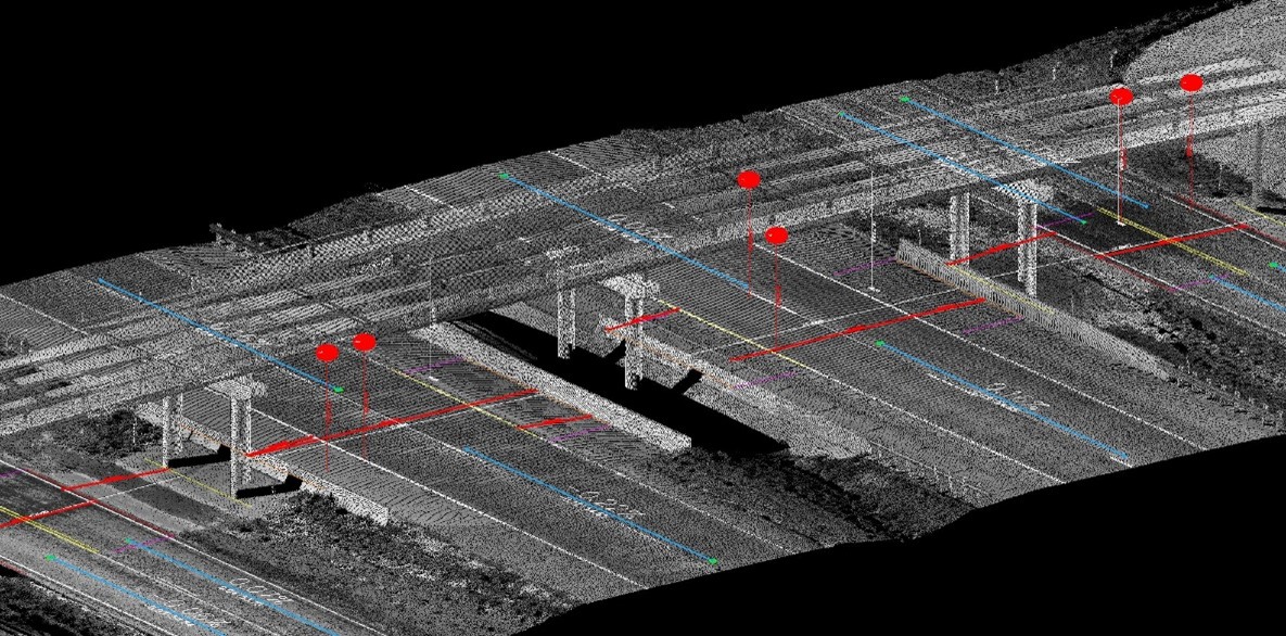
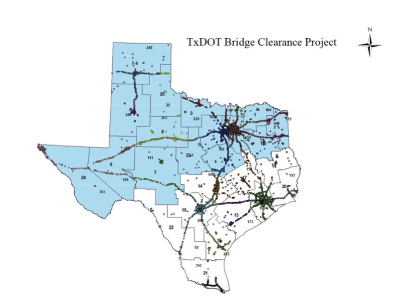
LTRA served as the prime provider for TxDOT’s Statewide Bridge Clearance Inventory Surveys, delivering critical data to support the safety and planning of the state’s roadway network. The project involved surveying more than 5,400 bridges across 13 TxDOT districts and 123 counties in North Texas, collecting accurate horizontal and vertical clearance measurements for every bridge opening. LTRA utilized the Leica Pegasus mobile mapping system to perform Mobile LiDAR scans of each structure, with point cloud data processed using MicroStation and TopoDOT software. The final deliverable included a comprehensive GIS database covering over 13,000 openings, each with approximately 60 recorded attributes. Our team also managed data collection planning, coordinated work across multiple regions, and implemented rigorous QA/QC processes to ensure data accuracy. LTRA’s ability to manage large-scale survey projects and deliver high-quality geospatial data contributed directly to TxDOT’s statewide bridge inventory and planning efforts.
Budget

Timeline

 – 

LTRA Logo Element Blue

Services provided

Terrestrial and mobile LiDAR
GIS database development
Survey planning and data management
QA/QC of survey data
Expedited large-scale LiDAR data collection and processing
Close and rapid coordination with client
Coordination and oversight of multiple teaming partners

Photo Gallery

Project highlights and key achievements

LTRA’s ability to manage large-scale survey projects and deliver high-quality geospatial data contributed directly to TxDOT’s statewide bridge inventory and planning efforts.

Blue LTRA vector

related project

Get In Touch

We’re glad you stopped by. Please drop us a line and introduce yourself. We enjoy collaborating with new people and discovering opportunities.

Keep Up
With LTRA

Follow us on social media